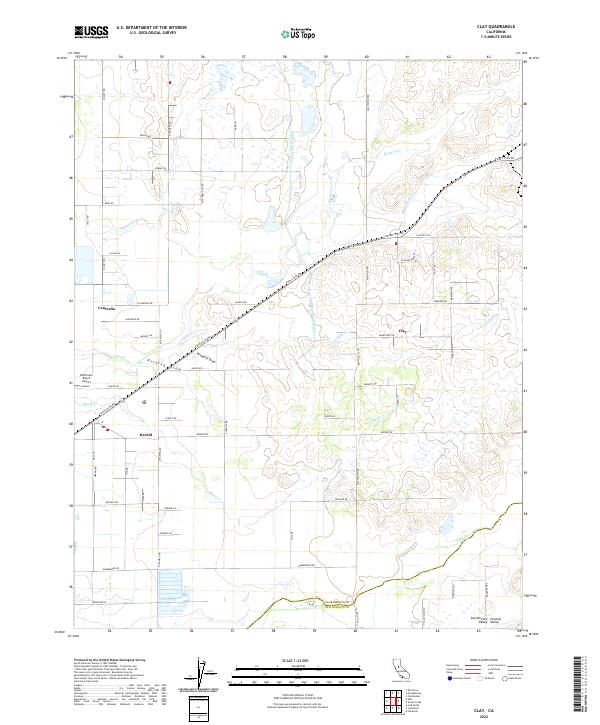
2022 Map of Clay
USGS Topo · Published 2022About this map
The community of Clay and the settlement at Herald anchor this agricultural landscape in the Sacramento Central Valley. This contemporary survey reveals a complex network of seasonal and permanent watercourses, including Badger Creek, Hadselville Creek, and Skunk Creek, alongside the engineered Folsom South Canal. The terrain is characterized by subtle drainage features like Rolling Draw and Windmill Draw, which dictate the local topography east of the Sacramento-San Joaquin County line. Transportation is defined by a rigid grid of rural routes such as Twin Cities Road and Alta Mesa Road, connecting disparate ranching operations and small rural hubs. Aviation history is represented by the Bottimore Ranch Airport near Centralia, illustrating the continued importance of private airstrips in California's expansive ranching regions.
Find a feature on this map
63 named features on this map. Tap any name to fly to it.
Don’t see what you’re looking for? This feature index may not catch every label — zoom into the map to look around manually.
Map Details
Editions of this 2022 Clay Map
This is the sole edition of this map. No revisions or reprints were ever made.
Other maps of this area

1894 · Lodi
USGS Topo · 1:125,000

1908 · Lockeford
USGS Topo · 1:31,680

1909 · Elk Grove
USGS Topo · 1:31,680

1909 · Carbondale
USGS Topo · 1:31,680

1909 · Clay
USGS Topo · 1:31,680

1909 · Cosumnes
USGS Topo · 1:31,680

1909 · Goose Creek
USGS Topo · 1:31,680

1909 · Clements
USGS Topo · 1:31,680

1910 · Woodbridge
USGS Topo · 1:31,680

1910 · Galt
USGS Topo · 1:31,680