
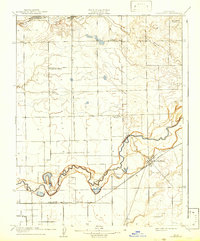
1908 Map of Lockeford
USGS Topo · Published 1908About this map
The Mokelumne River winds through the heart of this Central Valley landscape, anchoring the settlement of Lockeford at a critical rail junction. This early 20th-century survey illustrates a rural society organized around small school districts and the reach of the steam engine. The Southern Pacific RR and the Valley Springs Branch cut through the fields, facilitating the movement of agricultural goods that would have defined local commerce.
Find a feature on this map
16 named features on this map. Tap any name to fly to it.
Don’t see what you’re looking for? This feature index may not catch every label — zoom into the map to look around manually.
Map Details
Editions of this 1908 Lockeford Map
2 editions found
Other maps of this area

1894 · Lodi
USGS Topo · 1:125,000

1908 · Waterloo
USGS Topo · 1:31,680

1908 · Linden
USGS Topo · 1:31,680

1909 · Clay
USGS Topo · 1:31,680

1909 · Goose Creek
USGS Topo · 1:31,680

1909 · Clements
USGS Topo · 1:31,680

1910 · Castle
USGS Topo · 1:31,680

1910 · Woodbridge
USGS Topo · 1:31,680

1910 · Galt
USGS Topo · 1:31,680
1939 · Lodi
USGS Topo · 1:62,500