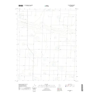
2019 Map of Clays Corner
USGS Topo · Published 2019About this map
Running Water Draw winds across this section of the High Plains, carving a distinct topographical depression through an otherwise orderly grid of agricultural lands. This 2019 survey of the area near Clays Corner illustrates the intersection of natural drainage patterns with the rigid section-line road system characteristic of Parmer County. The landscape is defined by its rural infrastructure, where routes like Fm 145 and a dense network of county roads including Co Rd 17 and Co Rd 24 facilitate the movement of local industry. Small depressions and scattered wetlands are visible throughout the quadrangle, highlighting the unique hydrology of the Llano Estacado. This map is a clean record of modern land use and transportation in a region where the vastness of the plains is managed by a precise network of thoroughfares.
Find a feature on this map
18 named features on this map. Tap any name to fly to it.
Don’t see what you’re looking for? This feature index may not catch every label — zoom into the map to look around manually.
Map Details
Editions of this 2019 Clays Corner Map
This is the sole edition of this map. No revisions or reprints were ever made.
Other maps of this area

1954 · Clovis
USGS Topo · 1:250,000

1958 · Clovis
USGS Topo · 1:250,000

1963 · Clays Corner
USGS Topo · 1:24,000

1963 · Lazbuddie
USGS Topo · 1:24,000

1963 · Lariat NE
USGS Topo · 1:24,000

1963 · Lazbuddie SW
USGS Topo · 1:24,000

1963 · Progress
USGS Topo · 1:24,000
1963 · Lazbuddie SE
USGS Topo · 1:24,000

1965 · Tam Anne
USGS Topo · 1:24,000

1965 · Parmerton
USGS Topo · 1:24,000