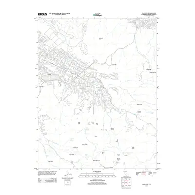
2012 Map of Clayton
USGS Topo · Published 2012About this map
Mount Diablo dominates the southern landscape of this 2012 survey, its massive slopes defined by a network of ridges and canyons including Eagle Peak, North Peak, and Mitchell Canyon. To the north, the transition from suburban development to open space is evident near Cowell and the Live Oak Cem. This area preserves significant industrial and social history, notably at the Kaiser Quarry and the site of Nortonville near Nortonville Pass. The geography is characterized by essential transit corridors like Kirker Pass Rd which threads through Kirker Pass, and recreational landmarks such as Muir Camp and Juniper Camp. The map provides a detailed view of the watershed, tracing the paths of Mount Diablo Cr and Galindo Cr as they flow through the foothills of Lime Ridge.
Find a feature on this map
67 named features on this map. Tap any name to fly to it.
Don’t see what you’re looking for? This feature index may not catch every label — zoom into the map to look around manually.
Map Details
Editions of this 2012 Clayton Map
This is the sole edition of this map. No revisions or reprints were ever made.
Other maps of this area

1896 · Carquinez Strait
USGS Topo · 1:62,500

1896 · Mt. Diablo
USGS Topo · 1:62,500

1897 · Concord
USGS Topo · 1:62,500

1898 · Karquines
USGS Topo · 1:62,500

1898 · Mt. Diablo
USGS Topo · 1:62,500

1901 · Karquines
USGS Topo · 1:62,500

1902 · Napa
USGS Topo · 1:125,000

1907 · Antioch
USGS Topo · 1:62,500

1908 · Antioch
USGS Topo · 1:62,500

1915 · Concord
USGS Topo · 1:62,500