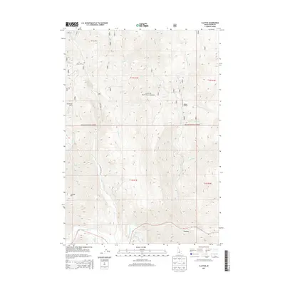
2013 Map of Clayton
USGS Topo · Published 2013About this map
Clayton anchors the southern edge of this map where the Salmon River carves through a landscape of high ridges and named gulches. The terrain is defined by a dense network of mountain drainages, including Kinnikinic Cr and Squaw Creek, which flow toward the Salmon valley. High-altitude landmarks such as Saturday Mtn and Happy Hollow sit within the expansive Challis National Forest, suggesting a region shaped by natural resource management and outdoor recreation. A notable local landmark, Sullivan Hot Springs, is found along Sullivan Cr just north of the river, highlighting the geothermal features typical of this central Idaho mountain range. The map illustrates the convergence of small tributaries like Foundry Cr and French Cr, tracing the rugged paths that connect these remote canyons to the main river corridor.
Find a feature on this map
30 named features on this map. Tap any name to fly to it.
Don’t see what you’re looking for? This feature index may not catch every label — zoom into the map to look around manually.
Map Details
Editions of this 2013 Clayton Map
This is the sole edition of this map. No revisions or reprints were ever made.
Other maps of this area

1919 · Custer
USGS Topo · 1:125,000

1922 · Custer
USGS Topo · 1:125,000

1929 · Bayhorse
USGS Topo · 1:125,000

1957 · Challis
USGS Topo · 1:250,000

1960 · Challis
USGS Topo · 1:250,000

1963 · Challis
USGS Topo · 1:250,000

1963 · Bald Mountain
USGS Topo · 1:24,000

1963 · Bayhorse Lake
USGS Topo · 1:24,000
1963 · Elevenmile Creek
USGS Topo · 1:24,000

1963 · Bayhorse
USGS Topo · 1:24,000