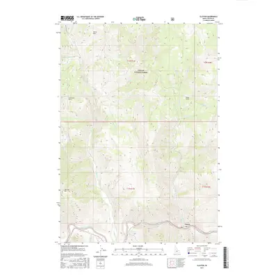
2017 Map of Clayton
USGS Topo · Published 2017About this map
The settlement of Clayton serves as the focal point of this Custer County survey, situated at the confluence where Kinnikinic Cr meets the Salmon River. This high-altitude landscape is dominated by the Challis National Forest, characterized by a complex drainage network including Squaw Creek, Sullivan Cr, and Cinnabar Cr. The terrain rises sharply toward landmarks like Saturday Mtn, while more sheltered areas like Happy Hollow and Spring Basin provide contrast to the steep canyons. A notable local feature is Sullivan Hot Springs, located south of the main river corridor. The map reflects the enduring geography of Idaho's mining and ranching country, tracing the paths of old gulches such as Cartwright Gulch and the numerous creeks that have shaped the region's development and access.
Find a feature on this map
30 named features on this map. Tap any name to fly to it.
Don’t see what you’re looking for? This feature index may not catch every label — zoom into the map to look around manually.
Map Details
Editions of this 2017 Clayton Map
This is the sole edition of this map. No revisions or reprints were ever made.
Other maps of this area

1919 · Custer
USGS Topo · 1:125,000

1922 · Custer
USGS Topo · 1:125,000

1929 · Bayhorse
USGS Topo · 1:125,000

1957 · Challis
USGS Topo · 1:250,000

1960 · Challis
USGS Topo · 1:250,000

1963 · Challis
USGS Topo · 1:250,000

1963 · Bald Mountain
USGS Topo · 1:24,000

1963 · Bayhorse Lake
USGS Topo · 1:24,000
1963 · Elevenmile Creek
USGS Topo · 1:24,000

1963 · Bayhorse
USGS Topo · 1:24,000