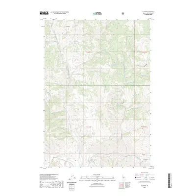
2023 Map of Clayton
USGS Topo · Published 2023About this map
The Salmon River carves through the southern reaches of this Custer County landscape, providing the primary topographical orientation for the town of Clayton. Just east of the settlement, the Clayton Cem sits above the riverbanks, serving as a focal point for local genealogical interest. The terrain is defined by a dense network of drainages and peaks within the Challis National Forest, including the prominent Saturday Mtn and the uniquely named Paasaskwana Naokwaide.
Find a feature on this map
32 named features on this map. Tap any name to fly to it.
Don’t see what you’re looking for? This feature index may not catch every label — zoom into the map to look around manually.
Map Details
Editions of this 2023 Clayton Map
This is the sole edition of this map. No revisions or reprints were ever made.
Other maps of this area

1919 · Custer
USGS Topo · 1:125,000

1922 · Custer
USGS Topo · 1:125,000

1929 · Bayhorse
USGS Topo · 1:125,000

1957 · Challis
USGS Topo · 1:250,000

1960 · Challis
USGS Topo · 1:250,000

1963 · Challis
USGS Topo · 1:250,000

1963 · Bald Mountain
USGS Topo · 1:24,000

1963 · Bayhorse Lake
USGS Topo · 1:24,000
1963 · Elevenmile Creek
USGS Topo · 1:24,000

1963 · Bayhorse
USGS Topo · 1:24,000