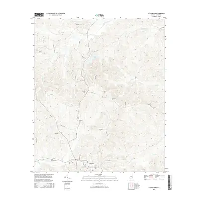
2014 Map of Clayton North
USGS Topo · Published 2014About this map
Clayton serves as the primary hub of activity in this part of Barbour County, situated at the junction of Al-51 and the AL-51-Byp. The landscape north of the town center is defined by a series of drainages including Johnson Cr, Bronson Cr, and Leak Cr, which feed into the larger Barbour Cr system. To the west, Ventress Pond and Pea Cr mark the low-lying areas near the Clayton Municipal Airport. The terrain rises to several named prominences, most notably Kennedy Hill and Graveyard Hill, the latter of which overlooks the surrounding creek valleys. Several small cemeteries are scattered throughout the rural landscape, including Jacksonville Cem, Blair Cem, and Mt Olive Cem, providing valuable points of reference for local family history and genealogy. A network of county roads like CR-49 and Gulledge Mill Rd connects these scattered landmarks to the more developed corridor near the Clayton Cem.
Find a feature on this map
54 named features on this map. Tap any name to fly to it.
Don’t see what you’re looking for? This feature index may not catch every label — zoom into the map to look around manually.
Map Details
Editions of this 2014 Clayton North Map
This is the sole edition of this map. No revisions or reprints were ever made.
Other maps of this area

1953 · Dothan
USGS Topo · 1:250,000

1954 · Dothan
USGS Topo · 1:250,000

1955 · Dothan
USGS Topo · 1:250,000

1955 · Phenix City
USGS Topo · 1:250,000

1957 · Phenix City
USGS Topo · 1:250,000

1958 · Phenix City
USGS Topo · 1:250,000

1967 · Clayton South
USGS Topo · 1:24,000

1968 · Baker Hill
USGS Topo · 1:24,000

1968 · White Oak
USGS Topo · 1:24,000

1968 · Clayton North
USGS Topo · 1:24,000