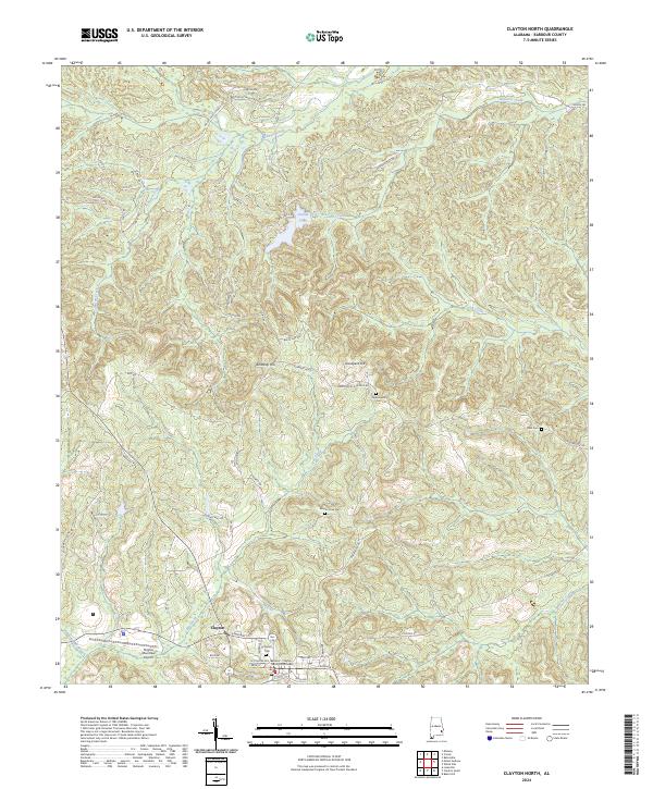
2024 Map of Clayton North
USGS Topo · Published 2024About this map
Clayton serves as the primary hub of this Barbour County landscape, characterized by a complex network of creeks and ridges. The town's historic core includes the Barbour - Clayton County Courthouse and the expansive Clayton Cem, marking the southern edge of the survey. Extending northward, the terrain rises toward Kennedy Hill and Graveyard Hill, overlooking the waters of County Lake and Pea Creek.
Find a feature on this map
60 named features on this map. Tap any name to fly to it.
Don’t see what you’re looking for? This feature index may not catch every label — zoom into the map to look around manually.
Map Details
Editions of this 2024 Clayton North Map
This is the sole edition of this map. No revisions or reprints were ever made.
Other maps of this area

1953 · Dothan
USGS Topo · 1:250,000

1954 · Dothan
USGS Topo · 1:250,000

1955 · Dothan
USGS Topo · 1:250,000

1955 · Phenix City
USGS Topo · 1:250,000

1957 · Phenix City
USGS Topo · 1:250,000

1958 · Phenix City
USGS Topo · 1:250,000

1967 · Clayton South
USGS Topo · 1:24,000

1968 · Baker Hill
USGS Topo · 1:24,000

1968 · White Oak
USGS Topo · 1:24,000

1968 · Clayton North
USGS Topo · 1:24,000