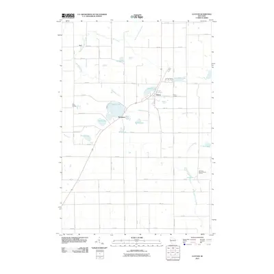
2010 Map of Clayton
USGS Topo · Published 2010About this map
Clayton and its surrounding glacial lake landscape are defined by a complex network of county highways and numbered avenues that divide the northern Wisconsin countryside into a regular grid. This survey documents the area's rural character, where small settlements like Joel and Richardson anchor a region rich in water bodies, including the large Magnor Lake and the elongated Long Lake. The map provides significant genealogical value, noting the locations of the Clayton Cemetery, West Clayton Cemetery, and the Holy Trinity Russian Orthodox Cemetery, the latter of which suggests the specific cultural and ethnic heritage of the settlers in this part of the state. Waterways like Nepadoggen Creek and the South Fork Hay River drain the terrain, connecting numerous smaller basins such as Camelia Lake and Little Moon Lake within this lacustrine environment.
Find a feature on this map
49 named features on this map. Tap any name to fly to it.
Don’t see what you’re looking for? This feature index may not catch every label — zoom into the map to look around manually.
Map Details
Editions of this 2010 Clayton Map
This is the sole edition of this map. No revisions or reprints were ever made.
Other maps of this area

1948 · Downing
USGS Topo · 1:62,500

1950 · Downing
USGS Topo · 1:62,500

1950 · Deer Park
USGS Topo · 1:62,500

1950 · Balsam Lake
USGS Topo · 1:62,500

1950 · Turtle Lake
USGS Topo · 1:62,500

1952 · Turtle Lake
USGS Topo · 1:62,500

1953 · Stillwater
USGS Topo · 1:250,000

1955 · Stillwater
USGS Topo · 1:250,000

1958 · Stillwater
USGS Topo · 1:250,000

1965 · Stillwater
USGS Topo · 1:250,000