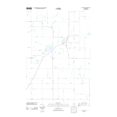
2013 Map of Clayton
USGS Topo · Published 2013About this map
Magnor Lake and Camelia Lake anchor a landscape defined by a dense network of glacial water bodies and meandering streams in this northern Wisconsin study. The village area near W Clayton Ave and E Clayton Ave serves as a local hub where Us-63 intersects with a grid of rural avenues and streets. This transport corridor aligns with the natural drainage patterns of Nepadoggen Cr and the upper reaches of the South Fork Hay River.
Find a feature on this map
74 named features on this map. Tap any name to fly to it.
Don’t see what you’re looking for? This feature index may not catch every label — zoom into the map to look around manually.
Map Details
Editions of this 2013 Clayton Map
This is the sole edition of this map. No revisions or reprints were ever made.
Other maps of this area

1948 · Downing
USGS Topo · 1:62,500

1950 · Downing
USGS Topo · 1:62,500

1950 · Deer Park
USGS Topo · 1:62,500

1950 · Balsam Lake
USGS Topo · 1:62,500

1950 · Turtle Lake
USGS Topo · 1:62,500

1952 · Turtle Lake
USGS Topo · 1:62,500

1953 · Stillwater
USGS Topo · 1:250,000

1955 · Stillwater
USGS Topo · 1:250,000

1958 · Stillwater
USGS Topo · 1:250,000

1965 · Stillwater
USGS Topo · 1:250,000