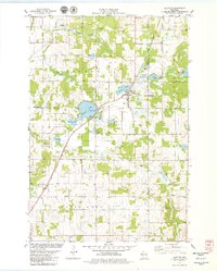
1978 Map of Clayton
USGS Topo · Published 1979About this map
The village of Clayton serves as the focal point of this late-1970s landscape, situated where the Chicago and North Western railroad passes between Camelia Lake and several industrial waste ponds. The area is defined by a dense network of glacial lakes, including Magnor Lake, Richardson Lake, and Paulson Lake, which support recreation through features like the Boat Ramp and Public Access points. This period shows a well-established rural community organized around its spiritual and civic institutions, as evidenced by Bethany Ch, Emmanuel Ch, and the Clayton Cemetery.
Find a feature on this map
37 named features on this map. Tap any name to fly to it.
Don’t see what you’re looking for? This feature index may not catch every label — zoom into the map to look around manually.
Map Details
Editions of this 1978 Clayton Map
This is the sole edition of this map. No revisions or reprints were ever made.
Other maps of this area

1948 · Downing
USGS Topo · 1:62,500

1950 · Downing
USGS Topo · 1:62,500

1950 · Deer Park
USGS Topo · 1:62,500

1950 · Balsam Lake
USGS Topo · 1:62,500

1950 · Turtle Lake
USGS Topo · 1:62,500

1952 · Turtle Lake
USGS Topo · 1:62,500

1953 · Stillwater
USGS Topo · 1:250,000

1955 · Stillwater
USGS Topo · 1:250,000

1958 · Stillwater
USGS Topo · 1:250,000

1965 · Stillwater
USGS Topo · 1:250,000