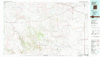
1982 Map of Clayton
USGS Topo · Published 1983About this map
Clayton serves as the primary hub of this high plains landscape during the early 1980s, situated where the Colorado and Southern railroad meets the drainage of Perico Creek. The map documents a sparsely populated ranching and agricultural region spanning the border between New Mexico and Texas, specifically tracing the transition from the volcanic landmarks of the Don Carlos Hills and Cinder Mountain in the west to the deep cuts of Tramperos Creek and Ute Creek in the south. Smaller rural communities like Sofia, Gladstone, and Beenham are connected by a network of ranch roads and an old railroad grade that hints at former transportation corridors. Researchers can identify local landmarks such as Cem de la Cruz near Miera and the distinctive landforms of Chavez Mountain and The Hogback, which define the rugged geography of Union and Harding Counties.
Find a feature on this map
45 named features on this map. Tap any name to fly to it.
Don’t see what you’re looking for? This feature index may not catch every label — zoom into the map to look around manually.
Map Details
Editions of this 1982 Clayton Map
This is the sole edition of this map. No revisions or reprints were ever made.
Other maps of this area

1954 · Santa Fe
USGS Topo · 1:250,000

1954 · Raton
USGS Topo · 1:250,000

1954 · Tucumcari
USGS Topo · 1:250,000

1954 · Dalhart
USGS Topo · 1:250,000

1958 · Raton
USGS Topo · 1:250,000

1958 · Santa Fe
USGS Topo · 1:250,000

1958 · Tucumcari
USGS Topo · 1:250,000

1958 · Dalhart
USGS Topo · 1:250,000

1962 · Dalhart
USGS Topo · 1:250,000

1966 · Royce
USGS Topo · 1:24,000