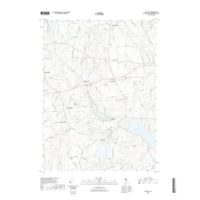
2018 Map of Clayville
USGS Topo · Published 2018About this map
Foster Center and the village of Clayville anchor this study of western Rhode Island, where the landscape is defined by the massive Scituate Reservoir and numerous family burying grounds. The map reveals the intricate network of brooks and swamps that feed into the reservoirs, including Bear Tree Brook and Westconnuag Brook, alongside smaller impoundments like Hopkins Mills Pond. This 2018 survey provides an invaluable resource for genealogists by identifying specific family-named cemeteries such as the Colonel Nathaniel Stone Lot Cem, the Phillips Plot, and the Daniel Howard Lot Cem. Landmarks like the Swamp Meadow Covered Bridge and Ponagansett Bridge signify the traditional architectural character preserved in this rural corridor. From the height of Chopmist Hill to the wetlands of Brush Meadow Swamp, the map documents a region where modern water management systems overlap with historical homesteads and settlements like Chopmist and South Foster.
Find a feature on this map
131 named features on this map. Tap any name to fly to it.
Don’t see what you’re looking for? This feature index may not catch every label — zoom into the map to look around manually.
Map Details
Editions of this 2018 Clayville Map
This is the sole edition of this map. No revisions or reprints were ever made.
Other maps of this area

1889 · Putnam
USGS Topo · 1:62,500

1889 · Burrillville
USGS Topo · 1:62,500

1889 · Moosup
USGS Topo · 1:62,500

1890 · Kent
USGS Topo · 1:62,500

1893 · Putnam
USGS Topo · 1:62,500

1893 · Moosup
USGS Topo · 1:62,500

1894 · Burrillville
USGS Topo · 1:62,500

1894 · Kent
USGS Topo · 1:62,500

1915 · Burrillville
USGS Topo · 1:62,500

1919 · Putnam
USGS Topo · 1:62,500