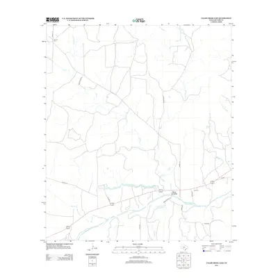
2012 Map of Clear Creek Lake
USGS Topo · Published 2012About this map
Beyer Crossing serves as a central landmark in this portion of the Texas Hill Country, situated near the meandering path of the San Saba River. The landscape is defined by an intricate network of seasonal drainages and permanent waterways, including the prominent Clear Cr Lake and the feeder streams of Silver Mine Cr and N Fork Dry Cr. This 2012 survey illustrates the transition from the river bottomlands to the drier uplands, where smaller tributaries like Coghlan Br and Ninemile Cr carve through the terrain.
Find a feature on this map
26 named features on this map. Tap any name to fly to it.
Don’t see what you’re looking for? This feature index may not catch every label — zoom into the map to look around manually.
Map Details
Editions of this 2012 Clear Creek Lake Map
This is the sole edition of this map. No revisions or reprints were ever made.
Other maps of this area

1892 · San Angelo
USGS Topo · 1:125,000

1892 · Eden
USGS Topo · 1:125,000

1893 · Fort McKavett
USGS Topo · 1:125,000

1896 · Eden
USGS Topo · 1:125,000

1954 · Brownwood
USGS Topo · 1:250,000

1954 · Llano
USGS Topo · 1:250,000

1954 · Sonora
USGS Topo · 1:250,000

1954 · San Angelo
USGS Topo · 1:250,000

1955 · Llano
USGS Topo · 1:250,000

1956 · Llano
USGS Topo · 1:250,000