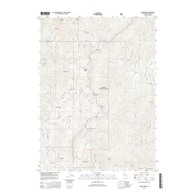
2015 Map of Clear Creek
USGS Topo · Published 2015About this map
The Klamath River carves a deep path through this portion of the Klamath National Forest, defining the rugged topography of the Siskiyou region. This 2015 survey documents the high-elevation terrain between Baldy Mtn Ridge and the Marble Mountains, where numerous drainages like Independence Cr and Titus Cr flow toward the primary river corridor. Small riverside settlements and flatlands, including Wingate Bar, Attebery Bar, and Ferry Point, mark the few areas of human habitation and transit along the water. The Thornton Memorial Bridge serves as a critical infrastructure point, connecting these isolated riverbank reaches. Significant elevation changes are highlighted by landmarks such as Titus Gap and Wingate Ridge, illustrating the complex drainage network that feeds into the Clear Creek watershed.
Find a feature on this map
43 named features on this map. Tap any name to fly to it.
Don’t see what you’re looking for? This feature index may not catch every label — zoom into the map to look around manually.
Map Details
Editions of this 2015 Clear Creek Map
This is the sole edition of this map. No revisions or reprints were ever made.
Other maps of this area

1914 · Seiad
USGS Topo · 1:125,000

1922 · Preston Peak
USGS Topo · 1:125,000

1922 · Seiad
USGS Topo · 1:125,000

1948 · Weed
USGS Topo · 1:250,000

1950 · Weed
USGS Topo · 1:250,000

1955 · Dillon Mtn
USGS Topo · 1:62,500

1955 · Ukonom Lake
USGS Topo · 1:62,500

1956 · Happy Camp
USGS Topo · 1:62,500

1956 · Preston Peak
USGS Topo · 1:62,500

1958 · Weed
USGS Topo · 1:250,000