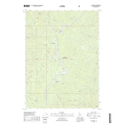
2018 Map of Clear Creek
USGS Topo · Published 2018About this map
The Klamath River carves a deep path through this section of the Klamath National Forest, defining the region's geography and history. This 2018 survey documents the small riverside settlements and bars that have long characterized the Klamath corridor, including Clear Creek, Wingate Bar, and Attebery Bar. The landscape is dominated by steep ridges such as Wingate Ridge and Baldy Mtn Ridge, intersected by a dense network of tributaries like Independence Creek and Titus Cr. For those researching local history or land use, the map highlights significant modern and historic crossing points, notably the Thornton Memorial Bridge and the location of Ferry Point. Further south, the terrain ascends toward the Marble Mountains and Coon Hollow, reflecting the transition from river-level flats to high-altitude wilderness.
Find a feature on this map
64 named features on this map. Tap any name to fly to it.
Don’t see what you’re looking for? This feature index may not catch every label — zoom into the map to look around manually.
Map Details
Editions of this 2018 Clear Creek Map
This is the sole edition of this map. No revisions or reprints were ever made.
Other maps of this area

1914 · Seiad
USGS Topo · 1:125,000

1922 · Preston Peak
USGS Topo · 1:125,000

1922 · Seiad
USGS Topo · 1:125,000

1948 · Weed
USGS Topo · 1:250,000

1950 · Weed
USGS Topo · 1:250,000

1955 · Dillon Mtn
USGS Topo · 1:62,500

1955 · Ukonom Lake
USGS Topo · 1:62,500

1956 · Happy Camp
USGS Topo · 1:62,500

1956 · Preston Peak
USGS Topo · 1:62,500

1958 · Weed
USGS Topo · 1:250,000