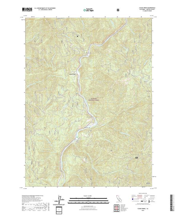
2022 Map of Clear Creek
USGS Topo · Published 2022About this map
Klamath National Forest dominates this landscape where the Klamath River carves a deep path through the northern reaches of the Marble Mountains. The river's course is punctuated by historical landings and gravel deposits like Wingate Bar and Attebery Bar, reflecting the long history of placer mining and river navigation in Siskiyou County. The small community of Clear Creek sits at the confluence where its namesake stream meets the larger river system, serving as a focal point for local travel along Ferry Point Rd. High ridges like Baldy Mtn Ridge and Titus Ridge create a series of steep drainages, including Titus Cr and Independence Creek. This terrain illustrates the rugged isolation of the Klamath corridor, where the protected Klamath Wild and Scenic River remains a central geographic feature.
Find a feature on this map
46 named features on this map. Tap any name to fly to it.
Don’t see what you’re looking for? This feature index may not catch every label — zoom into the map to look around manually.
Map Details
Editions of this 2022 Clear Creek Map
This is the sole edition of this map. No revisions or reprints were ever made.
Other maps of this area

1914 · Seiad
USGS Topo · 1:125,000

1922 · Preston Peak
USGS Topo · 1:125,000

1922 · Seiad
USGS Topo · 1:125,000

1948 · Weed
USGS Topo · 1:250,000

1950 · Weed
USGS Topo · 1:250,000

1955 · Dillon Mtn
USGS Topo · 1:62,500

1955 · Ukonom Lake
USGS Topo · 1:62,500

1956 · Happy Camp
USGS Topo · 1:62,500

1956 · Preston Peak
USGS Topo · 1:62,500

1958 · Weed
USGS Topo · 1:250,000