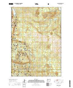
2020 Map of Clear Lake
USGS Topo · Published 2020About this map
Clear Lake sits at the headwaters of the McKenzie Wild and Scenic River, anchoring a volcanic landscape where the Cascade Range geology creates unique hydrological features. One of the most distinctive markers is the Underwater Forest, a site where ancient trees were preserved beneath the lake's surface by volcanic activity. The area is defined by the high-elevation terrain of the Willamette National Forest, where drainage from Icecap Spring and Anderson Cr feeds into the river system.
Find a feature on this map
26 named features on this map. Tap any name to fly to it.
Don’t see what you’re looking for? This feature index may not catch every label — zoom into the map to look around manually.
Map Details
Editions of this 2020 Clear Lake Map
This is the sole edition of this map. No revisions or reprints were ever made.
Other maps of this area

1929 · Three Sisters
USGS Topo · 1:125,000

1932 · Three Sisters
USGS Topo · 1:125,000

1934 · Mc Kenzie Bridge
USGS Topo · 1:96,000

1940 · Mc Kenzie Bridge
USGS Topo · 1:125,000

1953 · Salem
USGS Topo · 1:250,000

1954 · Salem
USGS Topo · 1:250,000

1955 · Echo Mountain
USGS Topo · 1:62,500

1955 · Mc Kenzie Bridge
USGS Topo · 1:62,500

1955 · Bend
USGS Topo · 1:250,000

1957 · Bend
USGS Topo · 1:250,000