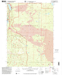
1997 Map of Clear Lake
USGS Topo · Published 2001About this map
Clear Lake serves as the focal point of this volcanic landscape, where the ancient Lava flows meet the headwaters of the McKenzie River. The map documents a complex hydrological system, from the subterranean waters surfacing at Icecap Spring to the dramatic plunges of Sahalie Falls and Koosah Falls. The presence of Carmen Reservoir and Beaver Marsh illustrates the varied character of the local waterways as they navigate the transition between the Willamette National Forest and the protected wilderness to the east.
Find a feature on this map
24 named features on this map. Tap any name to fly to it.
Don’t see what you’re looking for? This feature index may not catch every label — zoom into the map to look around manually.
Map Details
Editions of this 1997 Clear Lake Map
This is the sole edition of this map. No revisions or reprints were ever made.
Other maps of this area

1929 · Three Sisters
USGS Topo · 1:125,000

1932 · Three Sisters
USGS Topo · 1:125,000

1934 · Mc Kenzie Bridge
USGS Topo · 1:96,000

1940 · Mc Kenzie Bridge
USGS Topo · 1:125,000

1953 · Salem
USGS Topo · 1:250,000

1954 · Salem
USGS Topo · 1:250,000

1955 · Echo Mountain
USGS Topo · 1:62,500

1955 · Mc Kenzie Bridge
USGS Topo · 1:62,500

1955 · Bend
USGS Topo · 1:250,000

1957 · Bend
USGS Topo · 1:250,000