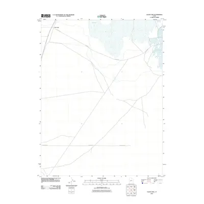
2010 Map of Clear Lake
USGS Topo · Published 2010About this map
Clear Lake sits within a landscape defined by its distinct hydrologic features and the simple grid of rural West-Central Utah. This early 21st-century survey documents the transition between the arid terrain and the significant water bodies that dominate the northern portion of the quadrangle. The namesake settlement of Clear Lake is positioned near the intersection of the railway and W 1200 North, serving as a focal point for the region's sparse infrastructure. Further north, the expansive Salt Lake and its associated wetlands contrast with the southern reaches where the Beaver River winds through the open flats. The map provides a clear look at the essential transportation routes of the era, including W 2600 North St, which cuts a straight line across the desert floor to connect this remote lakefront area with the broader Millard County road network.
Find a feature on this map
6 named features on this map. Tap any name to fly to it.
Don’t see what you’re looking for? This feature index may not catch every label — zoom into the map to look around manually.
Map Details
Editions of this 2010 Clear Lake Map
This is the sole edition of this map. No revisions or reprints were ever made.
Other maps of this area

1885 · Beaver
USGS Topo · 1:250,000

1885 · Sevier Desert
USGS Topo · 1:250,000

1953 · Richfield
USGS Topo · 1:250,000

1953 · Delta
USGS Topo · 1:250,000

1958 · Richfield
USGS Topo · 1:250,000

1958 · Delta
USGS Topo · 1:250,000

1962 · Delta
USGS Topo · 1:250,000

1962 · Tabernacle Hill
USGS Topo · 1:62,500

1971 · Pavant Butte North
USGS Topo · 1:24,000

1971 · Neels
USGS Topo · 1:24,000