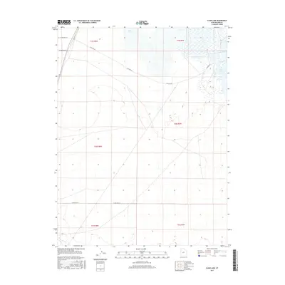
2017 Map of Clear Lake
USGS Topo · Published 2017About this map
The Beaver River winds through the southern reaches of this Millard County landscape, a stark desert region defined by its hydrography and vast sectioned townships. In the north, the waters of Salt Lake and Clear Lake serve as prominent focal points amidst the arid terrain. The map documents a sparse but deliberate network of local infrastructure, where long thoroughfares like Clearlake Rd and W 2600 North St provide the primary access through the Public Land Survey System grids of T19S, T20S, and T21S. This 2017 survey by the U.S. Geological Survey preserves the exact placement of these vital water sources and the grid of rural roads, including W 16000 South St, that support the region's ranching or agricultural operations.
Find a feature on this map
13 named features on this map. Tap any name to fly to it.
Don’t see what you’re looking for? This feature index may not catch every label — zoom into the map to look around manually.
Map Details
Editions of this 2017 Clear Lake Map
This is the sole edition of this map. No revisions or reprints were ever made.
Other maps of this area

1885 · Beaver
USGS Topo · 1:250,000

1885 · Sevier Desert
USGS Topo · 1:250,000

1953 · Richfield
USGS Topo · 1:250,000

1953 · Delta
USGS Topo · 1:250,000

1958 · Richfield
USGS Topo · 1:250,000

1958 · Delta
USGS Topo · 1:250,000

1962 · Delta
USGS Topo · 1:250,000

1962 · Tabernacle Hill
USGS Topo · 1:62,500

1971 · Pavant Butte North
USGS Topo · 1:24,000

1971 · Neels
USGS Topo · 1:24,000