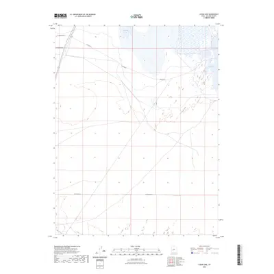
2023 Map of Clear Lake
USGS Topo · Published 2023About this map
Clear Lake dominates the eastern landscape of this Millard County interior, surrounded by a complex system of marshes and wetlands that define the local geography. The hydrology of the area is further marked by the presence of Salt Lake to the north and the winding course of the Beaver River along the southern edge. This 2023 survey illustrates a landscape primarily defined by its natural water features and a sparse network of section-line roads, such as W 2600 North St and W 16000 South St. The diagonal route of Clearlake Rd provides the primary access through this desert basin, connecting the various water bodies and remote topographic points. This modern topographic record is essential for understanding the contemporary state of Utah's Great Basin hydrology and the enduring rural infrastructure of the region.
Find a feature on this map
7 named features on this map. Tap any name to fly to it.
Don’t see what you’re looking for? This feature index may not catch every label — zoom into the map to look around manually.
Map Details
Editions of this 2023 Clear Lake Map
This is the sole edition of this map. No revisions or reprints were ever made.
Other maps of this area

1885 · Beaver
USGS Topo · 1:250,000

1885 · Sevier Desert
USGS Topo · 1:250,000

1953 · Richfield
USGS Topo · 1:250,000

1953 · Delta
USGS Topo · 1:250,000

1958 · Richfield
USGS Topo · 1:250,000

1958 · Delta
USGS Topo · 1:250,000

1962 · Delta
USGS Topo · 1:250,000

1962 · Tabernacle Hill
USGS Topo · 1:62,500

1971 · Pavant Butte North
USGS Topo · 1:24,000

1971 · Neels
USGS Topo · 1:24,000