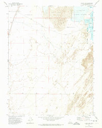
1971 Map of Clear Lake
USGS Topo · Published 1974About this map
Clear Lake and its surrounding wetlands form a distinct ecological pocket within the Sevier Desert of Millard County. The landscape is defined by a large depression where seasonal water and varied terrain meet, including an expansive Mud Flat to the north and fields of Lava and Sand Dunes to the southeast. The Union Pacific railroad corridor runs along the western edge, providing a vital transportation link past the small settlement of Clear Lake. This 1970s survey captures the area during the active oversight of the Clear Lake Waterfowl Management Area, showing the complex dikes and water controls used to maintain habitat in this arid basin. To the south, the Beaver River winds through the desert floor, marking the lower reaches of its drainage before it reaches the terminal sinks of the region.
Find a feature on this map
9 named features on this map. Tap any name to fly to it.
Don’t see what you’re looking for? This feature index may not catch every label — zoom into the map to look around manually.
Map Details
Editions of this 1971 Clear Lake Map
This is the sole edition of this map. No revisions or reprints were ever made.
Other maps of this area

1885 · Beaver
USGS Topo · 1:250,000

1885 · Sevier Desert
USGS Topo · 1:250,000

1953 · Richfield
USGS Topo · 1:250,000

1953 · Delta
USGS Topo · 1:250,000

1958 · Richfield
USGS Topo · 1:250,000

1958 · Delta
USGS Topo · 1:250,000

1962 · Delta
USGS Topo · 1:250,000

1962 · Tabernacle Hill
USGS Topo · 1:62,500

1971 · Pavant Butte North
USGS Topo · 1:24,000

1971 · Neels
USGS Topo · 1:24,000