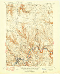
1929 Map of Clearfield
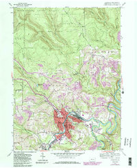
USGS Topo · Published 1956About this map
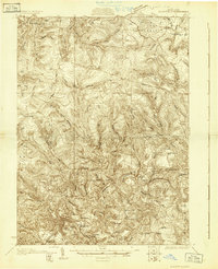
The Susquehanna River winds through a landscape of tight ridges and hollows in this late 1920s survey of central Pennsylvania. The county seat of Clearfield serves as the regional hub, where the B R and P and Pennsylvania railroads converge to support the area's timber and coal industries. The map documents a dense network of rural infrastructure, including numerous one-room schoolhouses like the Williams Dale Sch and Dale Sch, alongside spiritual centers such as Goshen Ch. Higher elevations are marked by utilitarian landmarks like the Public Fire Tower and the Ranger Sta near State Camp, reflecting the active forest management of the era. Smaller settlements like Lecontes Mills and Bishtown are shown in detail, providing a clear picture of township life before the expansion of modern highways.
Find a feature on this map
111 named features on this map. Tap any name to fly to it.
Don’t see what you’re looking for? This feature index may not catch every label — zoom into the map to look around manually.
Map Details
Editions of this 1929 Clearfield Map
2 editions found
Historical Maps of Clearfield Through Time
5 maps found