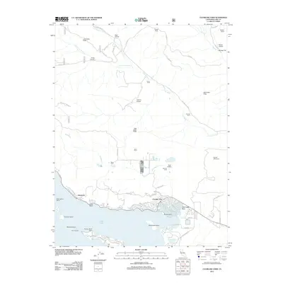
2012 Map of Clearlake Oaks
USGS Topo · Published 2012About this map
The northeastern shoreline of Clear Lake defines the character of this 2012 survey, where the developed waterfront of Clearlake Oaks meets the canal-front residences of Clear Lake Keys. This area represents a transition from high-density lakeside living to the sprawling ranchlands of the interior. North of the lake, the landscape is defined by its topographic complexity, including High Valley Ridge and Wolf Creek Ridge, which separate various agricultural holdings. Several family-named operations like Schindler Ranch, Garner Ranch, and Kennedy Ranch occupy the drainages of Long Valley Cr and Schindler Cr. A modern economic feature, the 5 Star Fish Farm, is situated between the ridges and the lake shore. Along the water, several islands such as Rattlesnake Island and Stubbs Island remain prominent landmarks, while Sulphur Bank Point and Honeymoon Cove mark the shoreline's southern reaches near the edge of the survey.
Find a feature on this map
61 named features on this map. Tap any name to fly to it.
Don’t see what you’re looking for? This feature index may not catch every label — zoom into the map to look around manually.
Map Details
Editions of this 2012 Clearlake Oaks Map
This is the sole edition of this map. No revisions or reprints were ever made.
Other maps of this area

1921 · Kelseyville
USGS Topo · 1:62,500

1924 · Bartlett Springs
USGS Topo · 1:62,500

1938 · Lakeport
USGS Topo · 1:62,500

1942 · Bartlett Springs
USGS Topo · 1:62,500

1943 · Kelseyville
USGS Topo · 1:62,500

1944 · Bartlett Springs
USGS Topo · 1:62,500

1945 · Lower Lake
USGS Topo · 1:62,500

1947 · Santa Rosa
USGS Topo · 1:250,000

1949 · Santa Rosa
USGS Topo · 1:250,000

1951 · Lakeport
USGS Topo · 1:62,500