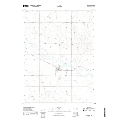
2017 Map of Clearwater
USGS Topo · Published 2017About this map
Clearwater serves as the central hub of this Antelope County landscape, situated where Frenchtown Rd and Nebraska ST intersect near the banks of the Elkhorn River. The town's grid is clearly defined by local thoroughfares such as Miles ST and 1st ST, while the surrounding countryside is marked by a legacy of local faith and memory. This is evident in the cluster of burial grounds nearby, including the Clearwater Cem, Saint Theresa Cem, and the Latter Day Saints Cem. The terrain is shaped by the winding courses of Clearwater Creek and Hackberry Cr, which weave through a section-line road network that includes Summerland Rd and several numbered routes like 857th RD. This 2017 survey reflects the persistent agricultural and small-town structure of rural Nebraska.
Find a feature on this map
31 named features on this map. Tap any name to fly to it.
Don’t see what you’re looking for? This feature index may not catch every label — zoom into the map to look around manually.
Map Details
Editions of this 2017 Clearwater Map
This is the sole edition of this map. No revisions or reprints were ever made.
Other maps of this area

1955 · O'Neill
USGS Topo · 1:250,000

1959 · O'Neill
USGS Topo · 1:250,000

1963 · Neligh
USGS Topo · 1:24,000

1963 · Neligh SE
USGS Topo · 1:24,000

1963 · Deloit
USGS Topo · 1:24,000

1963 · Neligh SW
USGS Topo · 1:24,000

1963 · Royal
USGS Topo · 1:24,000

1963 · Orchard
USGS Topo · 1:24,000

1963 · Ewing
USGS Topo · 1:24,000

1963 · Deloit NE
USGS Topo · 1:24,000