
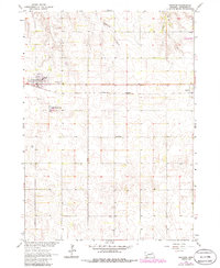
1963 Map of Orchard
USGS Topo · Published 1964About this map
Orchard and Royal anchor this 1963 survey of the Antelope County landscape, where the Chicago Burlington and Quincy railroad cuts a straight horizontal line across the plains. This transit corridor shaped local development, connecting the village center of Orchard to the surrounding rural townships of Sherman, Verdigris, and Garfield. The map reveals the community infrastructure of the early 1960s, including a prominent Water Tank and Sewage Disposal Ponds near the town site.
Find a feature on this map
18 named features on this map. Tap any name to fly to it.
Don’t see what you’re looking for? This feature index may not catch every label — zoom into the map to look around manually.
Map Details
Editions of this 1963 Orchard Map
2 editions found
Other maps of this area

1955 · O'Neill
USGS Topo · 1:250,000

1959 · O'Neill
USGS Topo · 1:250,000

1963 · Orchard NE
USGS Topo · 1:24,000

1963 · Neligh
USGS Topo · 1:24,000

1963 · Venus
USGS Topo · 1:24,000

1963 · Royal
USGS Topo · 1:24,000

1963 · Ewing
USGS Topo · 1:24,000

1963 · Deloit NE
USGS Topo · 1:24,000
1963 · Clearwater
USGS Topo · 1:24,000
1963 · Orchard NW
USGS Topo · 1:24,000