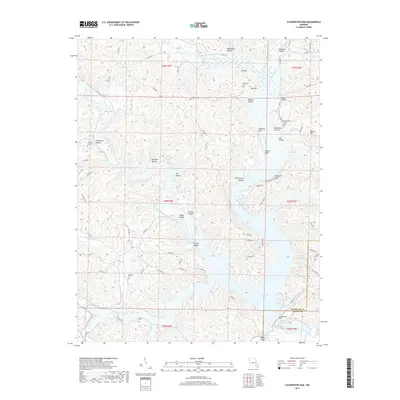
2017 Map of Clearwater Dam
USGS Topo · Published 2017About this map
The Black River flows through this Ozark landscape, dominated by the significant engineering of the Clearwater Dam and the resulting reservoir of Clearwater Lake. This modern survey illustrates the complex topography of the region, where numerous named hollows like McMillan Hollow and Mail Route Hollow drain into the river system. The map reveals a pattern of dispersed settlement, with community centers such as Pinedale Valley and Webb Valley serving as anchors for the rural road network. Local history is deeply etched into the land through a high density of family and community burial grounds, including Buffington Cem, Seematter Cem, and Skiles Cem. The presence of several natural springs, such as Mann Spring and Lucy Spring, indicates the karst geology characteristic of this part of the Missouri interior, while named high points like Red Hill and Round Mtn provide vertical relief against the deep river valleys.
Find a feature on this map
89 named features on this map. Tap any name to fly to it.
Don’t see what you’re looking for? This feature index may not catch every label — zoom into the map to look around manually.
Map Details
Editions of this 2017 Clearwater Dam Map
This is the sole edition of this map. No revisions or reprints were ever made.
Other maps of this area

1926 · Des Arc
USGS Topo · 1:62,500

1929 · Des Arc
USGS Topo · 1:62,500

1932 · Piedmont
USGS Topo · 1:62,500

1935 · Piedmont
USGS Topo · 1:62,500

1943 · Ellington
USGS Topo · 1:62,500

1943 · Lesterville
USGS Topo · 1:62,500

1945 · Ellington
USGS Topo · 1:62,500

1946 · Lesterville
USGS Topo · 1:62,500

1949 · Rolla
USGS Topo · 1:250,000

1953 · Rolla
USGS Topo · 1:250,000