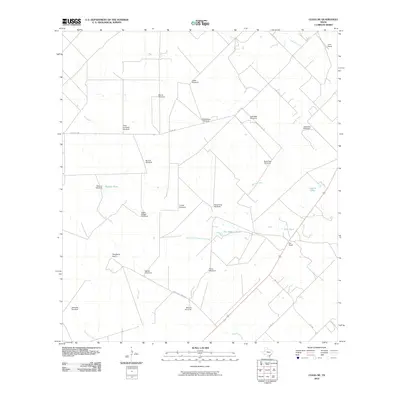
2010 Map of Clegg NE
USGS Topo · Published 2010About this map
The vast ranching country of Live Oak County is defined by a sparse network of county roads and vital water infrastructure. Large-scale livestock operations such as Lyne Ranch, Iley Ranch, and Daugherty Ranch dominate the terrain, supported by dozens of named windmills that serve as critical landmarks in this semi-arid landscape. Notable among these are the uniquely named Piggly Wiggly Windmill, Jack West Windmill, and Muerto Windmill.
Find a feature on this map
38 named features on this map. Tap any name to fly to it.
Don’t see what you’re looking for? This feature index may not catch every label — zoom into the map to look around manually.
Map Details
Editions of this 2010 Clegg NE Map
This is the sole edition of this map. No revisions or reprints were ever made.
Other maps of this area

1920 · Mikeska
USGS Topo · 1:125,000

1927 · Oakville
USGS Topo · 1:62,500

1929 · Simmons
USGS Topo · 1:62,500

1953 · Crystal City
USGS Topo · 1:250,000

1955 · Crystal City
USGS Topo · 1:250,000

1961 · Crystal City
USGS Topo · 1:250,000
1963 · Anna Rose
USGS Topo · 1:24,000
1963 · Elm Creek
USGS Topo · 1:24,000
1963 · Oakville SW
USGS Topo · 1:24,000

1968 · Crystal City
USGS Topo · 1:250,000