1963 Map of Elm Creek
USGS Topo · Published 1964About this map
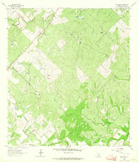
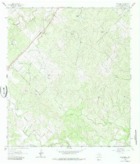
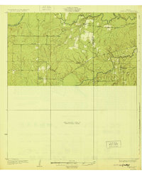
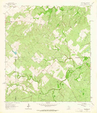
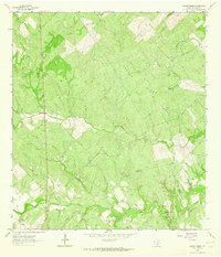
Oil Field development and water management infrastructure define this 1963 landscape in Live Oak County, where an extensive network of ranch tanks and pipelines overlays the brush country terrain. The map traces the winding paths of Elm Creek, Ramirena Creek, and Leopard Creek, which serve as the primary drainage for the area. A prominent Pipeline cuts diagonally across the northwestern section, illustrating the industrial footprint of the petroleum industry on this rural Texas landscape. Along the eastern edge, the elevation rise of Crater Ridge stands out against the surrounding draws like Long Hollow. Notable for genealogists and local historians, the sheet identifies specific man-made water features including Agarita Tank, Dumont Tank, and Javelina Tank, as well as a Quarry and various fence lines that denote property divisions and land use patterns during the early 1960s.
Find a feature on this map
17 named features on this map. Tap any name to fly to it.
Don’t see what you’re looking for? This feature index may not catch every label — zoom into the map to look around manually.
Map Details
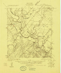
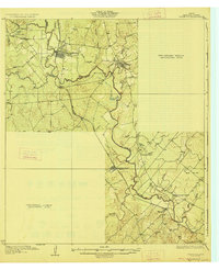
Editions of this 1963 Elm Creek Map
2 editions found
Other maps of this area

1920 · Mikeska
USGS Topo · 1:125,000
1925 · Oakville No. 4
USGS Topo · 1:48,000
1927 · Oakville
USGS Topo · 1:62,500
1929 · Simmons
USGS Topo · 1:62,500

1953 · Crystal City
USGS Topo · 1:250,000

1955 · Crystal City
USGS Topo · 1:250,000

1961 · Crystal City
USGS Topo · 1:250,000
1963 · Anna Rose
USGS Topo · 1:24,000
1963 · Crater Ridge
USGS Topo · 1:24,000

1963 · Oakville SW
USGS Topo · 1:24,000