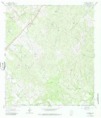
1963 Map of Elm Creek
USGS Topo · Published 1985About this map
An active Oil Field and a network of livestock watering sources define the landscape of this Live Oak County region during the early 1960s. The terrain is characterized by a complex drainage system, where the waters of Leopard Creek and its tributary Leopard Branch navigate the northern reaches, while the larger Elm Creek and Ramirena Creek cross the southern portion. The prevalence of named water tanks, such as Alamo Tank, Javelina Tank, and Agarita Tank, suggests a ranching economy where water management was vital for survival in this South Texas environment.
Find a feature on this map
15 named features on this map. Tap any name to fly to it.
Don’t see what you’re looking for? This feature index may not catch every label — zoom into the map to look around manually.
Map Details
Editions of this 1963 Elm Creek Map
2 editions found
Other maps of this area

1920 · Mikeska
USGS Topo · 1:125,000

1925 · Oakville No. 4
USGS Topo · 1:48,000

1927 · Oakville
USGS Topo · 1:62,500

1929 · Simmons
USGS Topo · 1:62,500

1953 · Crystal City
USGS Topo · 1:250,000

1955 · Crystal City
USGS Topo · 1:250,000

1961 · Crystal City
USGS Topo · 1:250,000
1963 · Anna Rose
USGS Topo · 1:24,000
1963 · Crater Ridge
USGS Topo · 1:24,000
1963 · Elm Creek
USGS Topo · 1:24,000