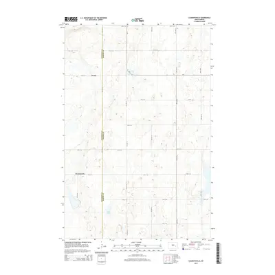
2014 Map of Clementsville
USGS Topo · Published 2014About this map
Clementsville and the nearby locale of Durupt anchor this 2014 survey of the rural landscape where Barnes and Stutsman Counties meet. This portion of North Dakota is defined by a rigorous grid of section-line roads, such as 20th St SE and 96th Ave SE, which organize the agricultural terrain and provide access to the area's numerous prairie potholes and seasonal wetlands. The most prominent natural water body, Scotts Lake, sits in the southern portion of the quadrangle. State highway ND-9 cuts through the northern sections, serving as a primary connector between these small farming communities. The map provides a detailed view of the regional drainage and elevation patterns, illustrating how the landscape transitions around these localized settlements and water features.
Find a feature on this map
20 named features on this map. Tap any name to fly to it.
Don’t see what you’re looking for? This feature index may not catch every label — zoom into the map to look around manually.
Map Details
Editions of this 2014 Clementsville Map
This is the sole edition of this map. No revisions or reprints were ever made.
Other maps of this area

1896 · Jamestown
USGS Topo · 1:125,000

1897 · Eckelson
USGS Topo · 1:125,000

1900 · Pingree
USGS Topo · 1:125,000

1951 · Spiritwood Lake
USGS Topo · 1:24,000

1951 · Courtenay
USGS Topo · 1:24,000

1952 · Bloom
USGS Topo · 1:24,000

1952 · New Rockford
USGS Topo · 1:250,000

1953 · Jamestown
USGS Topo · 1:250,000

1956 · New Rockford
USGS Topo · 1:250,000

1956 · Jamestown
USGS Topo · 1:250,000