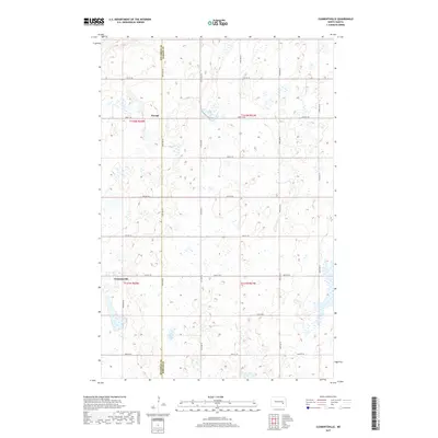
2017 Map of Clementsville
USGS Topo · Published 2017About this map
The boundary between Stutsman Co Barnes Co runs vertically through this prairie landscape, defining the rural character of these North Dakota townships. Small agrarian settlements including Clementsville and Durupt serve as anchor points within a strictly gridded network of section lines and gravel roads. This topography is characterized by numerous small potholes and wetlands, with Scotts Lake being the most prominent water body in the southern portion of the quadrangle. The map captures the enduring legacy of the Public Land Survey System, where modern infrastructure like Co Hwy 42 and 97th Ave SE continues to follow the early 19th-century township and range lines. This specific arrangement of roads and small water bodies provides a clear view of the glacial till plains that dictate the agricultural patterns of the region.
Find a feature on this map
23 named features on this map. Tap any name to fly to it.
Don’t see what you’re looking for? This feature index may not catch every label — zoom into the map to look around manually.
Map Details
Editions of this 2017 Clementsville Map
This is the sole edition of this map. No revisions or reprints were ever made.
Other maps of this area

1896 · Jamestown
USGS Topo · 1:125,000

1897 · Eckelson
USGS Topo · 1:125,000

1900 · Pingree
USGS Topo · 1:125,000

1951 · Spiritwood Lake
USGS Topo · 1:24,000

1951 · Courtenay
USGS Topo · 1:24,000

1952 · Bloom
USGS Topo · 1:24,000

1952 · New Rockford
USGS Topo · 1:250,000

1953 · Jamestown
USGS Topo · 1:250,000

1956 · New Rockford
USGS Topo · 1:250,000

1956 · Jamestown
USGS Topo · 1:250,000