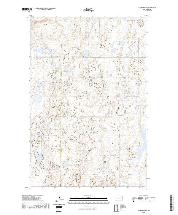
2024 Map of Clementsville
USGS Topo · Published 2024About this map
The boundary between Stutsman Co and Barnes Co bisects this prairie landscape, revealing a region defined by its numerous small wetlands and glacial depressions. Small settlements like Clementsville and Durupt serve as local landmarks within the section-line road grid that organizes the territory. The eastern portion of the map is dominated by the Barnes County Waterfowl Production Area, a large-scale conservation site that protects the natural hydrology of the North Dakota pothole region. This 2024 survey documents the persistence of the rural township structure, where local thoroughfares such as Co Hwy 42 and 26th St SE provide the primary connection between isolated farmsteads and these central gathering points. The map provides a precise view of the terrain's subtle relief and the vital water bodies that support local ecosystems and agriculture.
Find a feature on this map
18 named features on this map. Tap any name to fly to it.
Don’t see what you’re looking for? This feature index may not catch every label — zoom into the map to look around manually.
Map Details
Editions of this 2024 Clementsville Map
This is the sole edition of this map. No revisions or reprints were ever made.
Other maps of this area

1896 · Jamestown
USGS Topo · 1:125,000

1897 · Eckelson
USGS Topo · 1:125,000

1900 · Pingree
USGS Topo · 1:125,000

1951 · Spiritwood Lake
USGS Topo · 1:24,000

1951 · Courtenay
USGS Topo · 1:24,000

1952 · Bloom
USGS Topo · 1:24,000

1952 · New Rockford
USGS Topo · 1:250,000

1953 · Jamestown
USGS Topo · 1:250,000

1956 · New Rockford
USGS Topo · 1:250,000

1956 · Jamestown
USGS Topo · 1:250,000