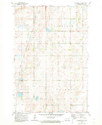
1970 Map of Clementsville
USGS Topo · Published 1973About this map
Clementsville sits at the heart of this North Dakota prairie landscape, where the township divisions of Gray, Uxbridge, Rose, and Brimer meet. The map reveals a transition in rural transport during the early 1970s, as the Soo Line railroad continues its path through the terrain while a significant section of track to the south is marked as Abandoned. This shift in the rail network mirrors the evolving settlement patterns near the Stutsman Co and Barnes Co line.
Find a feature on this map
11 named features on this map. Tap any name to fly to it.
Don’t see what you’re looking for? This feature index may not catch every label — zoom into the map to look around manually.
Map Details
Editions of this 1970 Clementsville Map
This is the sole edition of this map. No revisions or reprints were ever made.
Other maps of this area

1896 · Jamestown
USGS Topo · 1:125,000

1897 · Eckelson
USGS Topo · 1:125,000

1900 · Pingree
USGS Topo · 1:125,000

1951 · Spiritwood Lake
USGS Topo · 1:24,000

1951 · Courtenay
USGS Topo · 1:24,000

1952 · Bloom
USGS Topo · 1:24,000

1952 · New Rockford
USGS Topo · 1:250,000

1953 · Jamestown
USGS Topo · 1:250,000

1956 · New Rockford
USGS Topo · 1:250,000

1956 · Jamestown
USGS Topo · 1:250,000