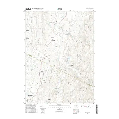
2016 Map of Clermont
USGS Topo · Published 2016About this map
Roeliff Jansen Kill winds through this landscape on the border of Columbia and Dutchess Counties, serving as a primary drainage for the area's many small lakes and creeks. The settlement pattern reflects a mix of historic hamlet clusters and agricultural land, with places like Blue Store and Bingham Mills situated along established corridors. In the northern reaches, Clermont and Manorton are anchored by significant local landmarks including the Clermont Cem and Saint John's Lutheran Cem. To the south, the village of Red Hook and its surrounding communities like Upper Red Hook and Cokertown are mapped in detail. The presence of Greig Farm Airport and bodies of water such as Warackamac Lake and Twin Lakes highlight the varied land use, from recreational and residential to rural infrastructure.
Find a feature on this map
135 named features on this map. Tap any name to fly to it.
Don’t see what you’re looking for? This feature index may not catch every label — zoom into the map to look around manually.
Map Details
Editions of this 2016 Clermont Map
This is the sole edition of this map. No revisions or reprints were ever made.
Other maps of this area

1895 · Catskill
USGS Topo · 1:62,500

1898 · Rhinebeck
USGS Topo · 1:62,500

1899 · Millbrook
USGS Topo · 1:62,500

1902 · Millbrook
USGS Topo · 1:62,500

1902 · Copake
USGS Topo · 1:62,500

1904 · Copake
USGS Topo · 1:62,500

1934 · Rhinebeck
USGS Topo · 1:48,000

1934 · Catskill
USGS Topo · 1:62,500

1938 · Catskill
USGS Topo · 1:62,500

1939 · Rhinebeck
USGS Topo · 1:62,500