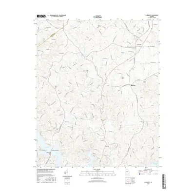
2017 Map of Clermont
USGS Topo · Published 2017About this map
Clermont and the nearby community of Brookton serve as the primary anchors of this North Georgia landscape where the foothills begin to transition toward the water. The southern reaches of the map are defined by the intricate shoreline of Lake Sidney Lanier, including the Wahoo Creek Access Point. This area demonstrates a complex hydrological network where the W Fork Little River and E Fork Little River converge toward the reservoir. Local history and genealogy are preserved in several established burial grounds such as Mount Vernon Cem, Dewberry Cem, and the high-elevation Walka Mountain Cem. The terrain is punctuated by significant landmarks like Buckhorn Mtn and Glade Shoals, while the Fly-N-S Ranch Airport indicates the continued rural aviation character of the region.
Find a feature on this map
152 named features on this map. Tap any name to fly to it.
Don’t see what you’re looking for? This feature index may not catch every label — zoom into the map to look around manually.
Map Details
Editions of this 2017 Clermont Map
This is the sole edition of this map. No revisions or reprints were ever made.
Other maps of this area

1886 · Dahlonega
USGS Topo · 1:125,000

1891 · Gainesville
USGS Topo · 1:125,000

1892 · Dahlonega
USGS Topo · 1:125,000

1896 · Dahlonega
USGS Topo · 1:125,000

1903 · Dahlonega
USGS Topo · 1:125,000

1951 · Cleveland
USGS Topo · 1:24,000
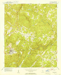
1951 · Dahlonega
USGS Topo · 1:24,000

1954 · Greenville
USGS Topo · 1:250,000

1958 · Greenville
USGS Topo · 1:250,000

1964 · Murrayville
USGS Topo · 1:24,000