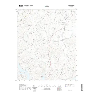
2020 Map of Clermont
USGS Topo · Published 2020About this map
Clermont and Brookton anchor this corner of Hall County, where the landscape is defined by the headwaters of the Little River and the northern reaches of Lake Sidney Lanier. The map reveals a dense network of family-named roads, such as Claude Parks Rd and Jones Mill Rd, which trace the ridges between numerous watercourses including Wahoo Creek and the East Fork Little River. A clear pattern of rural settlement is evident through the distribution of community landmarks like the Mount Vernon Cemetery and Dewberry Cemetery, alongside smaller geographic markers like Glade Shoals.
Find a feature on this map
160 named features on this map. Tap any name to fly to it.
Don’t see what you’re looking for? This feature index may not catch every label — zoom into the map to look around manually.
Map Details
Editions of this 2020 Clermont Map
This is the sole edition of this map. No revisions or reprints were ever made.
Other maps of this area

1886 · Dahlonega
USGS Topo · 1:125,000

1891 · Gainesville
USGS Topo · 1:125,000

1892 · Dahlonega
USGS Topo · 1:125,000

1896 · Dahlonega
USGS Topo · 1:125,000

1903 · Dahlonega
USGS Topo · 1:125,000

1951 · Cleveland
USGS Topo · 1:24,000
1951 · Dahlonega
USGS Topo · 1:24,000

1954 · Greenville
USGS Topo · 1:250,000

1958 · Greenville
USGS Topo · 1:250,000

1964 · Murrayville
USGS Topo · 1:24,000