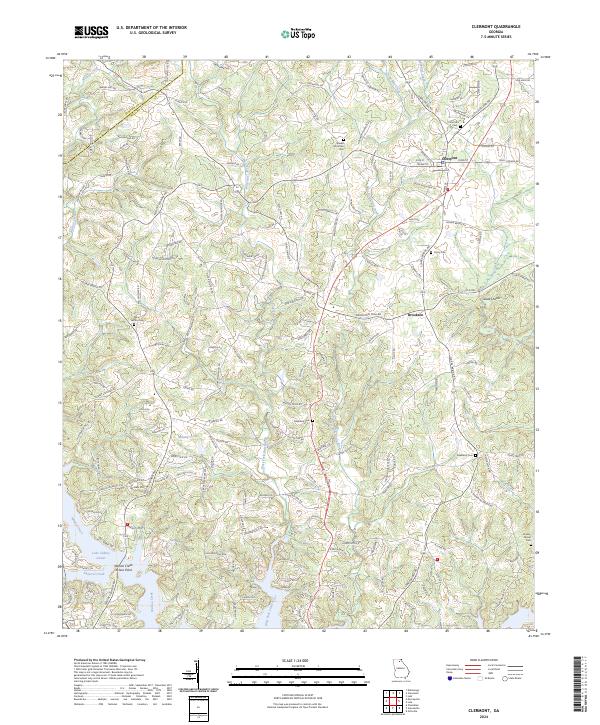
2024 Map of Clermont
USGS Topo · Published 2024About this map
Clermont and the nearby community of Brookton anchor this survey of the northeast Georgia uplands. The landscape is defined by the headwaters of several critical water systems, including the West Fork Little River and East Fork Little River, which flow south toward the expansive Lake Sidney Lanier. This contemporary topographic study reveals a terrain of dense family-named roads and rural infrastructure, from Glade Shoals to the slopes of Buckhorn Mtn.
Find a feature on this map
162 named features on this map. Tap any name to fly to it.
Don’t see what you’re looking for? This feature index may not catch every label — zoom into the map to look around manually.
Map Details
Editions of this 2024 Clermont Map
This is the sole edition of this map. No revisions or reprints were ever made.
Other maps of this area

1886 · Dahlonega
USGS Topo · 1:125,000

1891 · Gainesville
USGS Topo · 1:125,000

1892 · Dahlonega
USGS Topo · 1:125,000

1896 · Dahlonega
USGS Topo · 1:125,000

1903 · Dahlonega
USGS Topo · 1:125,000

1951 · Cleveland
USGS Topo · 1:24,000
1951 · Dahlonega
USGS Topo · 1:24,000

1954 · Greenville
USGS Topo · 1:250,000

1958 · Greenville
USGS Topo · 1:250,000

1964 · Murrayville
USGS Topo · 1:24,000