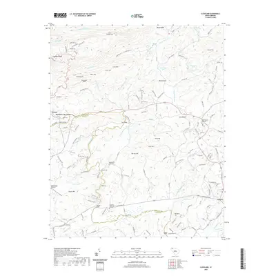
2020 Map of Cleveland
USGS Topo · Published 2020About this map
The Middle Saluda River and S Saluda River define the intricate topography of this Greenville and Pickens County borderland. High-elevation landmarks like Caesars Head and Little Pinnacle Mtn anchor the northern reaches, while the river valleys below are marked by a series of crossings including Tally Bridge, Mayfield Bridge, and Pace Bridge. The landscape transitions from the steep grades of Green Mtn and Persimmon Ridge to the more settled areas of Cleveland and Marietta in the south.
Find a feature on this map
161 named features on this map. Tap any name to fly to it.
Don’t see what you’re looking for? This feature index may not catch every label — zoom into the map to look around manually.
Map Details
Editions of this 2020 Cleveland Map
This is the sole edition of this map. No revisions or reprints were ever made.
Other maps of this area

1888 · Pickens
USGS Topo · 1:125,000

1894 · Pickens
USGS Topo · 1:125,000

1905 · Pisgah
USGS Topo · 1:125,000

1906 · Pisgah
USGS Topo · 1:125,000

1907 · Saluda
USGS Topo · 1:125,000

1935 · Brevard
USGS Topo · 1:24,000

1935 · Standingstone Mtn.
USGS Topo · 1:24,000

1935 · Greenville
USGS Topo · 1:48,000

1935 · Table Rock
USGS Topo · 1:24,000

1935 · Zirconia
USGS Topo · 1:24,000