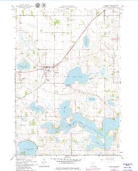
1965 Map of Cleveland
USGS Topo · Published 1979About this map
Cleveland sits at the intersection of rail and water in this mid-1960s study of Le Sueur County. The Chicago Milwaukee St Paul and Pacific railroad cuts a diagonal line through the landscape, passing just south of Savidge Lake and providing a transport spine through the townships of Sharon and Cleveland. The area is defined by a dense network of drainage works, including County Ditch No 51 and County Ditch No 60, which manage the many lakes and wetlands that dominate the local topography.
Find a feature on this map
36 named features on this map. Tap any name to fly to it.
Don’t see what you’re looking for? This feature index may not catch every label — zoom into the map to look around manually.
Map Details
Editions of this 1965 Cleveland Map
2 editions found
Other maps of this area

1950 · Mankato East
USGS Topo · 1:62,500

1951 · Mankato East
USGS Topo · 1:62,500

1953 · Saint Paul
USGS Topo · 1:250,000

1959 · Saint Paul
USGS Topo · 1:250,000

1965 · Cleveland
USGS Topo · 1:24,000
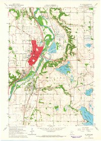
1965 · St Peter
USGS Topo · 1:24,000

1965 · Le Sueur
USGS Topo · 1:24,000

1965 · St Thomas
USGS Topo · 1:24,000

1966 · Cordova
USGS Topo · 1:24,000

1966 · Elysian
USGS Topo · 1:24,000