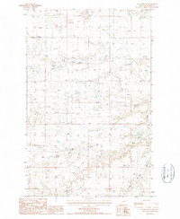
1987 Map of Cleveland NE
USGS Topo · Published 1987About this map
Snake Creek and Box Elder Creek define the drainage patterns across this north-central Montana landscape in Blaine County. The terrain is characterized by broad depressions like the Alkali Flats and a smaller Alkali Flat, reflecting the arid, mineral-rich hydrology of the region. A series of Levee structures along the watercourses indicate efforts to manage seasonal flows in a territory otherwise dominated by open range and ranching activity.
Find a feature on this map
11 named features on this map. Tap any name to fly to it.
Don’t see what you’re looking for? This feature index may not catch every label — zoom into the map to look around manually.
Map Details
Editions of this 1987 Cleveland NE Map
This is the sole edition of this map. No revisions or reprints were ever made.
Other maps of this area

1904 · Chinook
USGS Topo · 1:62,500

1905 · Harlem
USGS Topo · 1:62,500

1912 · Zurich
USGS Topo · 1:125,000

1913 · Cherry Ridge
USGS Topo · 1:125,000

1953 · Havre
USGS Topo · 1:250,000

1956 · Cleveland
USGS Topo · 1:62,500

1957 · Havre
USGS Topo · 1:250,000

1958 · Havre
USGS Topo · 1:250,000
1964 · Big Coulee
USGS Topo · 1:24,000
1964 · Fort Belknap Siding
USGS Topo · 1:24,000