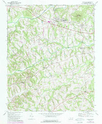
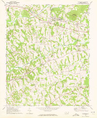
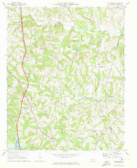
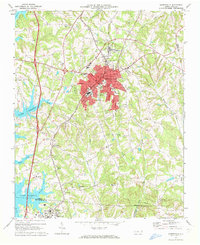
1970 Map of Cleveland
USGS Topo · Published 1989About this map
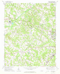
Cleveland and Barber serve as the primary hubs in this part of Rowan County, positioned along the Southern railroad line as it was surveyed in 1970. The landscape is characterized by a dense network of small waterways including Third Creek, Withrow Creek, and Back Creek, which shape the rural settlement patterns. Local history is deeply embedded in the community structures, from the West Rowan High Sch to numerous churches that anchor the surrounding townships, such as Thyatira Ch and Knox Chapel.
Find a feature on this map
29 named features on this map. Tap any name to fly to it.
Don’t see what you’re looking for? This feature index may not catch every label — zoom into the map to look around manually.
Map Details
Editions of this 1970 Cleveland Map
2 editions found
Other maps of this area

1893 · Statesville
USGS Topo · 1:125,000

1953 · Charlotte
USGS Topo · 1:250,000

1954 · Charlotte
USGS Topo · 1:250,000

1960 · Charlotte
USGS Topo · 1:250,000

1962 · Charlotte
USGS Topo · 1:250,000
1969 · Cooleemee
USGS Topo · 1:24,000
1969 · Cool Springs
USGS Topo · 1:24,000
1969 · Shepherds
USGS Topo · 1:24,000
1969 · Mooresville
USGS Topo · 1:24,000
1969 · Rowan Mills
USGS Topo · 1:24,000