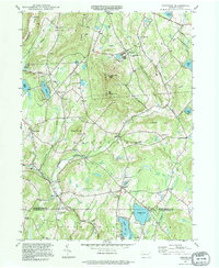
1994 Map of Clifford
USGS Topo · Published 1995About this map
The steep topography of Elk Hill and East Mountain dominates this portion of the Pennsylvania landscape, where the headwaters of Tunkhannock Creek carve through the narrow valleys of Susquehanna and Lackawanna counties. The settlement pattern here is deeply rooted in the 19th-century borough of Dundaff and the village of Clifford, which serve as historic anchors for the surrounding rural roads. Local history and genealogy are well-represented through numerous burial grounds, including Lyons Street Cem and Burdick Cem, alongside rural landmarks like Welch Hill Ch. The map highlights a transition from traditional agriculture and small-town centers to recreational and utility development, as seen in the proximity of Crystal Lake to modern infrastructure like the Radio Tower atop South Knob and the Carbondale-Clifford Airport.
Find a feature on this map
54 named features on this map. Tap any name to fly to it.
Don’t see what you’re looking for? This feature index may not catch every label — zoom into the map to look around manually.
Map Details
Editions of this 1994 Clifford Map
This is the sole edition of this map. No revisions or reprints were ever made.
Other maps of this area

1892 · Honesdale
USGS Topo · 1:62,500

1892 · Dundaff
USGS Topo · 1:62,500

1926 · Starrucca
USGS Topo · 1:62,500

1930 · Starrucca
USGS Topo · 1:48,000

1932 · Susquehanna
USGS Topo · 1:62,500

1933 · Starrucca
USGS Topo · 1:62,500

1935 · Susquehanna
USGS Topo · 1:62,500

1943 · Honesdale
USGS Topo · 1:125,000

1946 · Dalton
USGS Topo · 1:24,000

1946 · Forest City
USGS Topo · 1:24,000