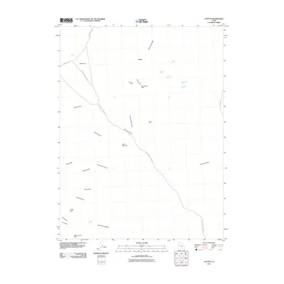
2011 Map of Clifton
USGS Topo · Published 2011About this map
Clifton is the central point of reference in this high-desert landscape, located within the Clifton Hills and bordered by the expansive Clifton Flat. The terrain is defined by its verticality and historical resource extraction, with the Monocco Mine and Midas Mine marking the region's mineral interests. A network of primitive roads, including Deep Creek Mountains Rd and Lower Gold Hill Rd, provide the only access through deep incisions like Uiyabi Canyon and Overland Canyon. High summits such as Montezuma Peak, Young Peak, and Abercrombie Peak overlook a system of vital water sources including Minnehaha Spring, Goshute Spring, and Skinner Spring. This landscape illustrates the classic Great Basin pattern of isolated peaks and canyons where survival and industry were dictated by the location of scarce water and ore deposits.
Find a feature on this map
31 named features on this map. Tap any name to fly to it.
Don’t see what you’re looking for? This feature index may not catch every label — zoom into the map to look around manually.
Map Details
Editions of this 2011 Clifton Map
This is the sole edition of this map. No revisions or reprints were ever made.
Other maps of this area

1908 · Fish Springs
USGS Topo · 1:250,000

1910 · Fish Springs
USGS Topo · 1:250,000

1925 · Gold Hill
USGS Topo · 1:62,500

1928 · Gold Hill
USGS Topo · 1:62,500

1953 · Tooele
USGS Topo · 1:250,000

1953 · Delta
USGS Topo · 1:250,000

1955 · Tooele
USGS Topo · 1:250,000

1958 · Delta
USGS Topo · 1:250,000

1962 · Delta
USGS Topo · 1:250,000
1972 · Goshute Canyon
USGS Topo · 1:24,000