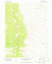
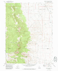
1972 Map of Goshute Canyon
USGS Topo · Published 1975About this map
The Deep Creek Range dominates this 1970s survey, marking a rugged boundary between Tooele Co and Juab Co. This remote desert landscape is defined by its canyon systems, including Hardscrabble Canyon, Reilly Canyon, and Goshute Canyon, which drain eastward toward the valley floor. Evidence of the region's mining heritage is scattered throughout the high elevations, with specific sites like the Eagles Nest Mine, the Oro del Rey Mine, and several unnamed prospects indicating the historical search for precious metals in these steep drainages.
Find a feature on this map
29 named features on this map. Tap any name to fly to it.
Don’t see what you’re looking for? This feature index may not catch every label — zoom into the map to look around manually.
Map Details
Editions of this 1972 Goshute Canyon Map
3 editions found

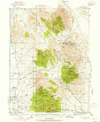
Other maps of this area

1908 · Fish Springs
USGS Topo · 1:250,000

1910 · Fish Springs
USGS Topo · 1:250,000
1925 · Gold Hill
USGS Topo · 1:62,500

1928 · Gold Hill
USGS Topo · 1:62,500

1953 · Tooele
USGS Topo · 1:250,000

1953 · Delta
USGS Topo · 1:250,000

1955 · Tooele
USGS Topo · 1:250,000

1958 · Delta
USGS Topo · 1:250,000

1962 · Delta
USGS Topo · 1:250,000
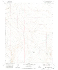
1972 · Mud Lake Reservoir
USGS Topo · 1:24,000