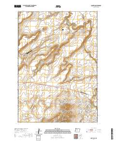
2020 Map of Cline Falls
USGS Topo · Published 2020About this map
The Deschutes River carves a dramatic path through this high desert terrain, punctuated by Cline Falls and Odin Falls as it flows north toward Steamboat Rock. The landscape is defined by its volcanic geology, featuring prominent landmarks like Cline Buttes and LaFollette Butte, alongside the deep incisions of McKenzie Canyon and Buckhorn Canyon. Modern development is concentrated in the southern portion of the sheet, where the resort community of Eagle Crest sits near the river. This 2020 record of the region highlights a mix of rural ranch roads, such as White Gates Ranch Rd, and specialized aviation facilities including The Citadel Airport and the Cline Falls Air Park. Water management is evident in the presence of the Deep Canyon Reservoir, supporting local needs within this arid Deschutes County environment.
Find a feature on this map
91 named features on this map. Tap any name to fly to it.
Don’t see what you’re looking for? This feature index may not catch every label — zoom into the map to look around manually.
Map Details
Editions of this 2020 Cline Falls Map
This is the sole edition of this map. No revisions or reprints were ever made.
Other maps of this area

1926 · Bend
USGS Topo · 1:125,000

1929 · Bend
USGS Topo · 1:125,000

1955 · Bend
USGS Topo · 1:250,000

1957 · Bend
USGS Topo · 1:250,000

1958 · Bend
USGS Topo · 1:250,000

1961 · Redmond
USGS Topo · 1:24,000

1962 · Opal City
USGS Topo · 1:24,000

1962 · Forked Horn Butte
USGS Topo · 1:24,000
1962 · Redmond
USGS Topo · 1:24,000
1962 · Cline Falls
USGS Topo · 1:24,000