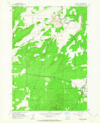
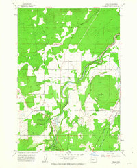
1962 Map of Cline Falls
USGS Topo · Published 1963About this map
The Deschutes River carves a deep, winding path through this volcanic landscape of Central Oregon, marked by notable cataracts and canyons. The river’s elevation drops significantly as it passes Odin Falls and the primary drop at Cline Falls, where a nearby Powerhouse and Gaging Station indicate the early industrial use of the waterway. The land to the west is dominated by the Cline Buttes and the prominent La Follette Butte, rising above a network of canyons including Deep Canyon and McKenzie Canyon. Evidence of mid-century industrial activity is scattered across the plateau, including an Oremite Mine, a Strip Mine, and various gravel pits. Historical infrastructure like the Canal in the northwest and the Cline Falls Highway serve the agricultural and recreational needs of the area around Cline Falls State Park.
Find a feature on this map
28 named features on this map. Tap any name to fly to it.
Don’t see what you’re looking for? This feature index may not catch every label — zoom into the map to look around manually.
Map Details
Editions of this 1962 Cline Falls Map
3 editions found
Other maps of this area

1926 · Bend
USGS Topo · 1:125,000

1929 · Bend
USGS Topo · 1:125,000

1955 · Bend
USGS Topo · 1:250,000

1957 · Bend
USGS Topo · 1:250,000

1958 · Bend
USGS Topo · 1:250,000

1961 · Redmond
USGS Topo · 1:24,000

1962 · Opal City
USGS Topo · 1:24,000

1962 · Forked Horn Butte
USGS Topo · 1:24,000
1962 · Redmond
USGS Topo · 1:24,000
1962 · Tumalo
USGS Topo · 1:24,000