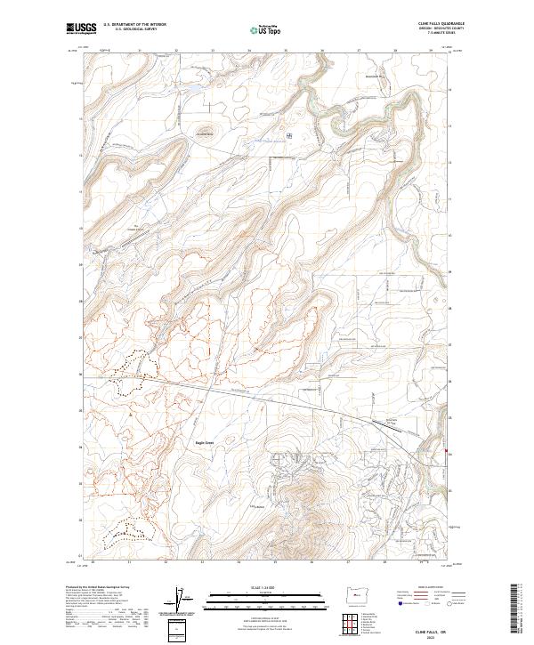
2023 Map of Cline Falls
USGS Topo · Published 2023About this map
Eagle Crest and the surrounding volcanic terrain define this Central Oregon landscape along the eastern edge of the Cascades. The Deschutes Wild and Scenic River carves a deep, winding corridor through the basalt, punctuated by significant water features including Big Falls, Odin Falls, and Cline Falls. To the west, the arid uplands are marked by distinct geological formations like Lafollette Butte and the rugged Cline Buttes, showing a landscape shaped by ancient volcanic activity and modern water management. The area's aviation utility is visible through The Citadel Airport and the Cline Falls Air Park, while the Deep Canyon Reservoir and numerous canyons such as Buckhorn Canyon and McKenzie Canyon illustrate the complex drainage patterns of the high desert.
Find a feature on this map
94 named features on this map. Tap any name to fly to it.
Don’t see what you’re looking for? This feature index may not catch every label — zoom into the map to look around manually.
Map Details
Editions of this 2023 Cline Falls Map
This is the sole edition of this map. No revisions or reprints were ever made.
Other maps of this area

1926 · Bend
USGS Topo · 1:125,000

1929 · Bend
USGS Topo · 1:125,000

1955 · Bend
USGS Topo · 1:250,000

1957 · Bend
USGS Topo · 1:250,000

1958 · Bend
USGS Topo · 1:250,000

1961 · Redmond
USGS Topo · 1:24,000

1962 · Opal City
USGS Topo · 1:24,000

1962 · Forked Horn Butte
USGS Topo · 1:24,000
1962 · Redmond
USGS Topo · 1:24,000
1962 · Cline Falls
USGS Topo · 1:24,000